Karanis Housing Project
about the project
------ Meet the Team ------
Karanis, modern Kom Aushim, was a medium-sized agricultural settlement located in the Egyptian Fayum. In the late nineteenth century, William Grenfell, Arthur Hunt, and David Hogarth, using contemporary papyri, affirmed the importance of Karanis in the network of towns and villages of the Fayum, an assessment that Flinders Petrie had presented initially. The difficulty of excavating houses and the scarcity of papyri led these early excavators to abandon work at the site.
The Michigan excavations were first conducted under the direction of J. L. Starkey (1924–1926), and subsequently with Enoch E. Peterson at the helm (1926–1935). Before the arrival of the Michigan team, the mining company Daira Agnelli Gianotti had exercised a permit to extract the nutrient-rich fertilizer, or sebbakh, that was found at the site. The company removed as much as 200 cubic metres from the centre of the mound each day. Boak and Peterson described the condition of the site at the arrival:
A large area in the heart of the mound, apparently about the centre of town, had been cleared down to bed rock by the sebbakhin, so that it had the appearance of the crater of some extinct volcano for which the high sides of the mound supplied the rim.
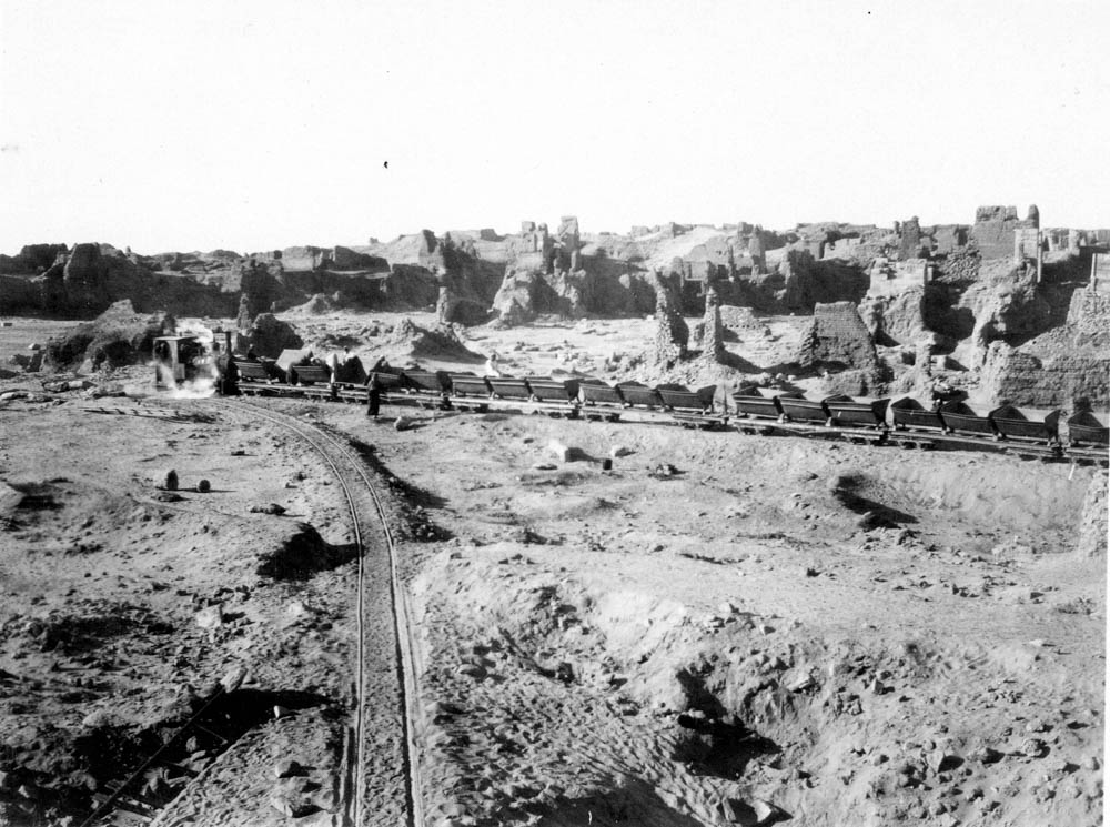
The rail line at Karanis, removing soil from the center of the mound. Kelsey Museum of Archaeology Negative 0417. Image copyright Kelsey Museum of Archaeology. Used with permission.
For the next ten years, with some interruptions, the Michigan team excavated Karanis, recording artifacts as they were removed from the soil. Uniquely for the time, the Michingan excavations carefully recorded their work through detailed field journals, excavation diaries, maps, plans, photographs and even a moving picture, that are currently kept at the Kelsey Museum at the University of Michigan. Most remarkably, the artifacts, as they emerged from the earth, were documented according to the building or room in which they were discovered.
End-users of the Karanis Geographic Information System will to be able to both search for the contents of specific buildings and also identify all instances of particular class of objects or specific finds, spatially locating them in the digital map of the site. You can read a detailed white paper about the project here: Karanis Housing Project White Paper